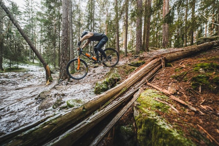
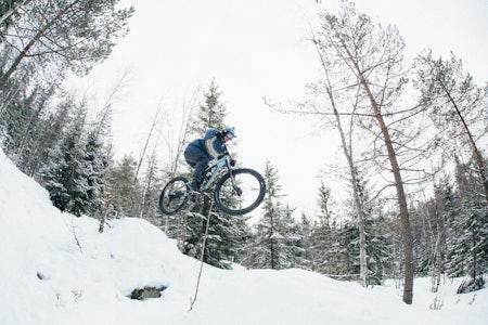
Gol-Oslo offroad via Vassfaret (210 km, 18h)I write this in english in case foreign visitors would like to spend two days on MTB in the norwegian wilderness. Maps 1:50 000 Gol (#607), Sør-Valdres (#2555), Strømsoddbygda (#729), Sperillen(#887), Oslo Nordmark sommer (#2423). And eventually Hønefoss (map 1815-II) for plan B DAY 2. All maps are found at Norli bookstore in Oslo. You also need a cottagekey from DNT. Also bring a small headlamp. You may be able to arrange food shopping and delivery halfway at Storruste in Vassfaret by calling this shop in Hedalen. This trip has never been described before. The trip goes through nice and wild mountain and forest landscape. In case you wish to make this a three day trip you may stay the first night at Hellebekk. This B&B is 3-4h biking uphill from Gol.DAY 1: Train to Gol leaves from Oslo S saturdays 08:11 a.m. Arriving Gol at 1100 a.m. Start from the train station (altitude 200 m) by following the small road on the southbank of the river 2,5 km to Eikle. Cross the farm to access the bridge over the river and continue on the road uphill. Good quality asphalt road upto lake Grøset (lunchbreak 1?), Kyrkja (altitude 1000 m) and Rauddalen (about 25km from Gol). From here you have two alternatives: Plan A: 1h including 1km unbikeable track down to the eastshore of lake Høvren. NB! There is no track for 200 m along the lakeshore. Crossing the tiny river is possible without wetting your shoes. Study the ground carefully to find the hardlu visible, unbikeable track on the southside of the lake. Take the road down to the first lake of the Alketjern lakes. Plan B: 30mn/12 km road via Hellebekk and lake Hølervatnet down to the first lake Alketjern. Plan B stop. After the first and second lake Alketjern (midtre Alketjern), take left on the singletrack road via lake Blekkatjern upto Vangen farm. Downhill to lake Strøen. Singletrack road 5 km along lake Strøen. At the southend of lake Strøen you have again two alternatives to access the Vassfaret valley: Plan A: Continue straight ahead on the east side of the river downto the end of the road. Follow the tractortrack 500 m and then carry the bike through the forest down to Suluvasshytta by the lake Suluvatnet. There is a hardly visible footpath indicated with red paint down to the lake. Plan B: At the southend of lake Strøen, take a rightturn to cross the dam and follow the road on the westside of the river. 1 km indicated (unbikeable?) track down to lake Suluvatnet. Plan B stop. Follow the almost bikeable track until the end of the lake (lunchbreak 2?) and acces the road at Dreparhølen. From here you have 20 km of nice riding through the Vassfaret valley. You may cross the Aurdøla river after Manmyrane to take the last 3 km down to Storruste/Kongevegen in Hedalen on the southside of the river. After the bridge you must take a sharp leftturn to cross the little Fjellelva river on foot. Good occassion to wet your shoes. Find the road and continue downhill to the Kongevegen track close to Storruste in the Hedalen valley (altitude 300 m). Take a right at the information board and start the uphill through Vidalen (altitude 600 m) and then down to the DNT cottage Buvasskoia (altitude 300 m, 110 km from Gol). You may need a headlamp to find the cottage in the late summer evening. You may access the lake by carrying the bike 100 m straight through the forest, or follow the road to the end and take the bikeable foothpath. The cottage is 10 m from the lakeshore 50 m straight after the footbridge. You deserve a nice dip in the lake.DAY 2: Take the footpath to the south from the cottage and access the road to Frisvatnet. From here you have an asphalted road 15 km through the habited Strømsoddbygda. At Hallvadshytta, about 20 km from Buvasskoia, take a left just before the bridge over the river Sogna to access a small forest road. Find the road up Rådalen and between the two lakes Vælsvnt. Lunch1 at the Øvre Vælsvannet dam? Continue the road down towards Hallingby. Plan A: From Hallingby, follow the highway E68 10 km south towards Hønefoss. At Vågård, take a left on the small forest road 500 m after the footbridge over the highway. Follow this forestroad 2-3km and take a right just before the farm down to the mainroad. Follow the road southwards (bicycle lane) and take a left towards Hval. Cross the larger bridge over the river (altitude 200m) and pass under the railroad. Take a right uphill to Haug church and continue uphill to Klekken. Plan B: To avoid the highway you need map 1815-II over Hønefoss. Do not cross the river at Hallingby. Stay on the west side of the river from Skollerud southwards. Cross the river after 10 km and access Klekken. Plan B stop. From Klekken you have an easy access to the Nordmarka forest with a nice uphill to Jaklefoss where you take a right to climb the last 3 km to Högåsen (altitude 600m). Downhill to lake Storflåten. After Storflåten, take a right uphill to Heggelia. At Heggelia you can shop (Lunch 2). Ask for "vafler med rømme". From Heggelia you find the road down to the Parking at Skansebakken in Sørkedalen. You return to Oslo via the lake Bogstadvannet, Røa, Smestad and Majorstua. Well done!

Gol-Oslo via Vassfaret
Du leser nå en eldre, brukergenerert stiguide, skrevet av en av våre lesere. Terrengsykkel.no har ikke verifisert at denne informasjonen stemmer. Husk å alltid sette deg inn i lokale stiforhold og eventuelle ferdselsrestriksjoner.
HVOR?
- Kommune: Oslo - Nordmarka
- Lengde: ikke angitt
- Tidsbruk: ikke angitt
- Vanskelighetsgrad: 6. ikke angitt
Slik kommer du dit
Tog
Endepunkt
Oslo
Terreng
Fjell og skog
Rutebeskrivelse
Publisert 16. juni 2003 kl 00.00
Sist oppdatert 16. juni 2003 kl 00.00